Munich Maps and Orientation
(Munich, Bavaria, Germany)
Standing on the far southern side of Germany, in the Upper Bravia region, Munich is the third biggest city in the country and home to a population of more than one million inhabitants. Sited alongside the River Isar, Munich stands on the northern side of the beautiful Bavarian Alps, which are just 50 km / 31 miles from the city and offers a range of recreational activities, including hiking trails.
Munich is a particularly attractive city and stands within the Northern Alpine Foreland region, enjoying a fairly elevated setting. Much of southern Munich is dominated by a hilly landscape, an area formed by glacial deposits.
Maps and Orientation of the City
The city contains a particularly diverse selection of buildings, with modern architecture playing an important part in the ever changing face of Munich. The majority of the city's high-rise buildings lie within Munich's northern region and include many major corporations and office blocks. Located within the city's Olympia Area district, the Olympiaturm Tower is currently the tallest structure in the whole of Munich and measures almost 300 metres / 985 feet in height.
The city is well connected to the rest of Germany and is extremely close to many popular cities and towns, including nearby Salzburg, the fourth-biggest city in Austria and located to the south-east of Munich. The following locations are also close to Munich and make excellent day trips.
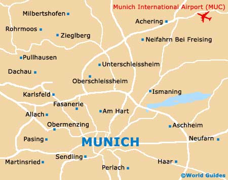
- Dachau - 19 km / 12 miles (25 minutes, north-west)
- Erding - 56 km / 35 miles (50 minutes, north-east)
- Freising - 40 km / 25 miles (40 minutes, north-east)
- Fürstenfeldbruck - 30 km / 19 miles (35 minutes, west)
- Germering - 21 km / 13 miles (25 minutes, west)
- Milbertshofen - 40 km / 25 miles (40 minutes, north)
- Moosach - 8 km / 5 miles (15 minutes, north-west)
- Oberding - 48 km / 30 miles (45 minutes, north-east)
- Ottobrunn - 13 km / 8 miles (15 minutes, south-east)
- Puchheim - 22 km / 14 miles (25 minutes, west)
- Taufkirchen - 13 km / 8 miles (20 minutes, south)
- Unterhaching - 11 km / 7 miles (16 minutes, south)
- Zorneding - 24 km / 15 miles (25 minutes, south-east)
Map of Germany

Map of Munich